
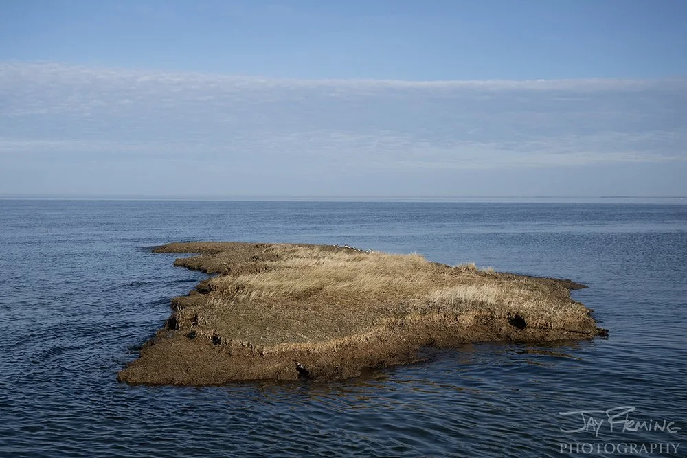
James Island at the mouth of the Little Choptank River is a landmass that totaled approximately 1350 acres when it was first settled in the 1660’s. At one point, the landmass was connected to the mainland of neighboring Taylor’s Island in Dorchester County, Maryland. By the late 1870’s, the island hosted a small community with two dozen homes, a store, and a school house. The community on the island was eventually abandoned due to the visible signs of the island washing away with the erosive forces of the Chesapeake. In the 20th century the island was used for harvesting timber (loblolly pines) and a hunting preserve for waterfowl and the introduced sika deer. Erosion continued to eat away at the island’s landmass, eventually breaking the once contiguous landmass into multiple islets or fragments. The once thriving coastal pine forest continued to fall into the bay and by late 2022/early 2023 all of the trees on the island had become obstructions to boaters navigating the shallow waters in search of fish and waterfowl.
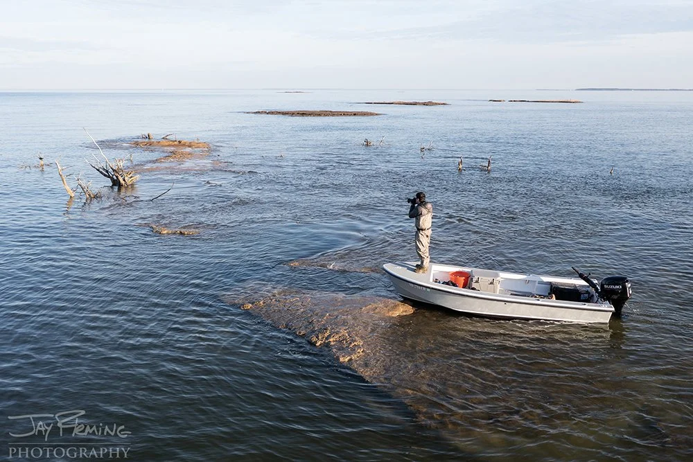
During my time working on Island Life, I visited James Island three times to document how the forces of the Chesapeake were changing the landscape. I launched my skiff from Slaughter Creek which is approximately six miles by water to the island. I would set up camp on the island to take advantage of the late evening light and early morning light while shooting this series. James was included in the ‘Islands of the Past’ chapter of the book with islands like Hollands, Bloodsworth, Poplar and Watts - all formerly inhabited islands that had been abandoned by full time residents. During my last visit to James Island in January 2023, it was obvious that the days were numbered for the landmass - the island fragments were significantly smaller than they were during my previous visits and nearly all of the vegetation that could help suppress the erosion was gone. It is likely that all traces of James Island will be completely gone within the next year.
The fate of the James is similar to that of Poplar Island which lies approximately 20 miles to the north in Talbot County. Like James, Poplar was once inhabited and by the late 1990’s had eroded down to island fragments that were a small fraction of the size when they were first surveyed. Since the early 2000’s Poplar Island has been rebuilt in a collaborative effort between the Army Corps of Engineers and the Maryland Port Authority with material dredged from the shipping channels of the Upper Chesapeake Bay. Poplar has been restored to approximately 1700 acres and is nearly at capacity with dredge material. Looking for a new location to dispose of dredge material, the Army Corps has had its sights set on James and Barren Island (approximately 10 miles to the south of James) - this project is known as the Mid Chesapeake Bay Island Ecosystem Restoration. Once complete, the $1.9 billion project is set to bring the landmass of James Island to approximately 2100 acres and add 72 acres to Barren Island. Work on James is projected to begin in 2024 with the creation of a rip rap (stone) perimeter and in 2028 dredge material will be barged in and added to recreate the island. The recreation of the island will help maintain access in the bay’s channels for large ships while recreating historical wildlife habitat and protecting adjacent shores on the mainland from erosion.
The photographs below in this blog post illustrate the changes in the landscape on James Island from 1928 to 2023.
January 2023


December 2021


April 2019


Historic Photographs
Island resident Captain J. Everett Dean at his home on James Island, Md, 1928. Courtesy of family photo collection of Stephanie Coleman Elliott, source: The Grace Foundation


A collection of photographs from the late 1950’s and early 1960’s by Baltimore Sun photographer Aubrey Bodine. Courtesy of Jennifer Bodine and the A. Aubrey Bodine Collection. Source www.aaubreybodine.com
Top left: looking west at James Island from the Little Choptank River. May 1963
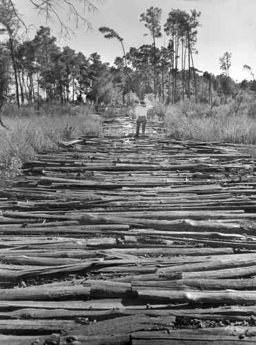
Top Middle: a road made by loggers that cut through the marshy areas of James Island. Timber was harvested from the island for years - contributing to the accelerated erosion of the island. March 1960
Top Right: marsh and upland on James Island. 1959
Bottom Left: James Island caretaker Carl Bush holds the skull of a sika deer, a small deer indigenous to Asia that was introduced to James Island in 1916
Bottom Right: the last structure on James Island was the caretakers cabin where caretaker Carl Bush and his wife lived.

James Island in May of 1982. Photograph courtesy Chesapeake Bay Program/Kent Mountford - www.chesapeakebay.net/news/blog/a-scientists-decades-long-portrait-of-a-vanishing-chesapeake-island

Aerial photograph of James Island in 1999 with the northwestern point of Taylors Island on the top left portion of the frame. Photograph courtesy of David Harp