Following a book presentation at the Virginia Institute of Marine Sciences in Wachapreague, Virginia, I had an opportunity to explore Virginia's seaside with Annapolis photographer, Bill Misch. Bill has taken my Hoopers Island and Smith Island photography workshops. Bill extended an offer to stay at his family's vacation home in Wachapreague for three days while we explored the shallow creeks and inlets of the seaside.
Most of our exploring was centered around Cedar Island - a narrow barrier island that extends north to south approximately five miles. Cedar Island is a dynamic island, with sands constantly shifting from wind and wave action. Dozens of buildings on stood on the island, with the last house falling into the ocean in 2014. The Coast Guard station on the north end is the last remaining structure, it sits approximately 100 yards west of the breaking waves of the Atlantic. Cedar Island hosts an incredible number of nesting birds, including the hard-to-photograph Black Skimmer. This was the prime time to photograph the nesting colonies, as the eggs had just hatched and adults were actively bringing fish back to the chicks.
The waterways of the seaside are dramatically different from those in the Chesapeake Bay. Narrow marsh creeks, sand bars, oyster bars extending out of the water and shifting channels make it a difficult area to navigate. My smaller skiff - 17' privateer - was the perfect vessel for navigating the erratic bottom.

The decommissioned Coast Guard station on Cedar Island, now privately owned, is an icon to the Barrier Islands. The Coast Guard station is the last remaining structure of dozens that once stood on the island.

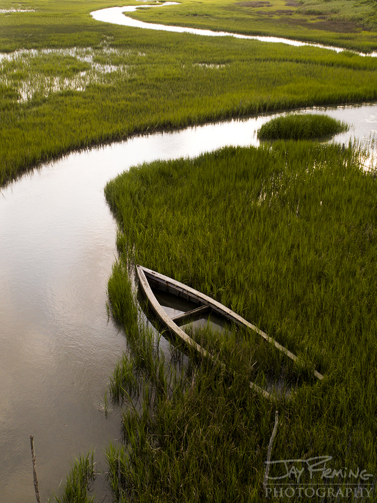
Sunset light over the marsh looking west from Cedar Island to Folly Creek.


The maritime forest on Parramore Island falling victim to the forces of the Atlantic Ocean.

Dawson's Shoal is a waterbird nesting site at the mouth of Wachapreague Inlet.


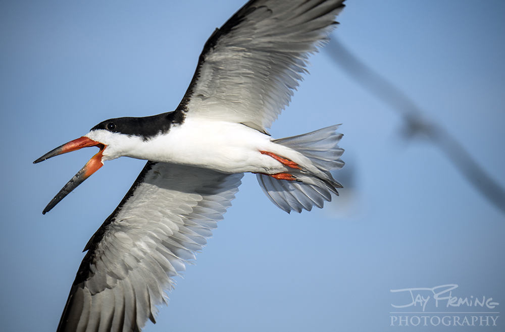

Thousands of Black Skimmers utilize the remote beaches of Virginia's Barrier Islands for nesting grounds during the summer months.